Lidar
Nainital is geographically located in 'free tropospheric' zone and is reasonably sparse from the point of view of major pollution, making the site quite suitable to study aerosol loading and climate variability. In lower atmosphere aerosols and trace gases are considered to be the most important entities in the radiation budget and climatic variability. Such unique location being at a high altitude (~2 km amsl) which is a natural advantage of Nainital, demands for regular and systematic observations of atmospheric parameters, to understand the various atmospheric processes.
Mie Lidar
A Mie Lidar was developed at ARIES using optimized optics, mechanics and advanced electronics for data acquisition and processing. Optical design Design analysis for 380 mm Cassegrain telescope and back-end detection optics were carried out in ZEMAX-EE simulation package to optimize system parameters.

A high power Q-switched, Nd: YAG solid state pulsed laser form Quanta systems S.P.A, Italy was used as transmitter for the LIDAR system. The Detector and Data Acquisition System (DDAS) of LIDAR comprises of detection unit containing Photo multiplier tube (PMT) as detector with cooling unit and power supply unit. It also includes amplifier and discriminator unit along with Multi-Channel Scalar (MCS) package. A computational program was developed implementing Fernald method to compute extinction coefficients and aerosols optical depth in the Matrix Laboratory (MATLAB) environment. A motorized roll-off-roof was designed and installed for carrying out Lidar observations at night. The system is presently employed for study of atmospheric aerosols and clouds via the Mie scattering up ~ 20Km above ground level during night time. Systematic error on retrieved extinction profiles by taking fixed Lidar ratio of 30 over the entire range for our observations showed the variation is about 10-12% in the lower altitudes and 5 -7 % in the higher altitudes. Mie Lidar system was employed to observe thin and thick cloud during January 2010. Thin cloud layer was observed at about 10 km and thick cloud layer was seen between 5 and 9 km. Results are also compared with MODIS & AERONET and agree within one standard deviation.
MPL-Lidar
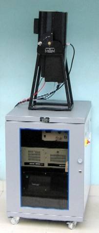
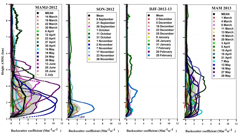
 A micro pulse Lidar was installed in a temperature controlled room at ARIES, Manora Peak, Nainital, in May 2006. This LIDAR has designed and developed at National Atmospheric Research laboratory (NARL), Gadanki, Tirupati. Since, Manora Peak is located geographically in free tropospheric zone, the site is conducive for evaluating the aerosol loading effects on the atmosphere due to the aerosol transportation from nearby polluted valley regions and also the long range aerosol transportation from far off regions to this height, apparently discernible during the major dust storms. In this perspective the LIDAR observations of tropospheric aerosols are being carried out for the first time, in the central Himalayan region at an altitude of ~2.0 km above mean sea level with a range resolution of 0.03 km. During the observations the LIDAR system collects the backscattered laser returns from the atmospheric aerosol and high altitude clouds.
Micro pulse LiDAR is basically used to make the measurements of vertical profiles of lower atmosphere, particularly vertical distribution of aerosols. The system is based on the principle of micro pulse Light Detection and Ranging (LiDAR) technique, and the dominant mechanism to get the backscattered profile is mainly the Mie scattering in the lower troposphere. The system is operated intermittently once a week unless there is any episodic event. The system has been utilized to measure the elevated aerosol layers originating as a result of long range transport of aerosols and for the vertical profiling of aerosols of the continental origin.


