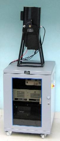
MPL-Lidar
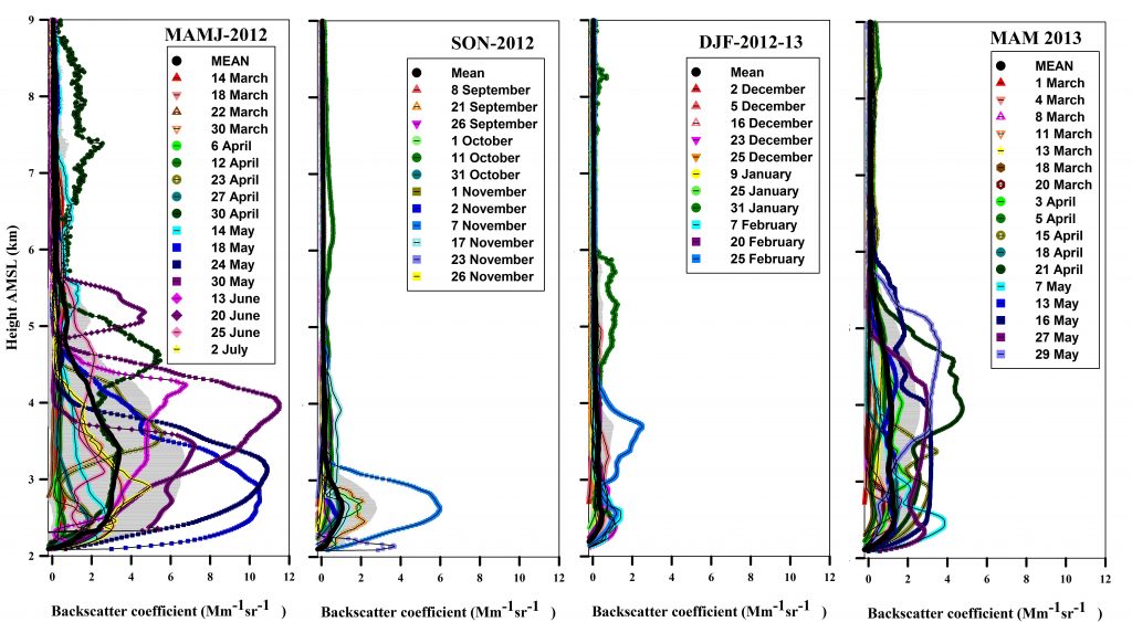
A micro pulse Lidar was installed in a temperature controlled room at ARIES, Manora Peak, Nainital, in May 2006. This LIDAR has designed and developed at National Atmospheric Research laboratory (NARL), Gadanki, Tirupati. Since, Manora Peak is located geographically in free tropospheric zone, the site is conducive for evaluating the aerosol loading effects on the atmosphere due to the aerosol transportation from nearby polluted valley regions and also the long range aerosol transportation from far off regions to this height, apparently discernible during the major dust storms. In this perspective the LIDAR observations of tropospheric aerosols are being carried out for the first time, in the central Himalayan region at an altitude of ~2.0 km above mean sea level with a range resolution of 0.03 km. During the observations the LIDAR system collects the backscattered laser returns from the atmospheric aerosol and high altitude clouds.
Micro pulse LiDAR is basically used to make the measurements of vertical profiles of lower atmosphere, particularly vertical distribution of aerosols. The system is based on the principle of micro pulse Light Detection and Ranging (LiDAR) technique, and the dominant mechanism to get the backscattered profile is mainly the Mie scattering in the lower troposphere. The system is operated intermittently once a week unless there is any episodic event. The system has been utilized to measure the elevated aerosol layers originating as a result of long range transport of aerosols and for the vertical profiling of aerosols of the continental origin.